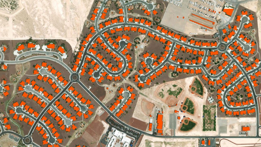
Federal Government, Aerial Mapping, GIS Mapping, LiDAR, MainHistoric Structure Footprint Extraction from LiDAR Imagery Oct 9, 2024