
Structural Footprint Extraction from LiDAR Imagery for the Department of Defense
Project Overview
As a part of a larger Department of Defense contract, Chronicle Heritage was requested to digitize the footprint of historic structures within a military installation under a condensed timeframe. While conceptually simple, this manual process would necessitate imperfect digitization from available aerial imagery, which pushed the GIS Team to examine options for extracting additional information from publicly-available remotely-sensed data.
Our Approach
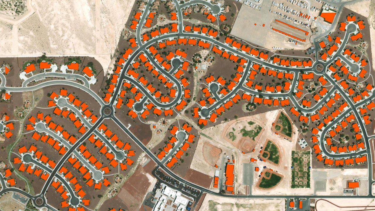
Data was first sourced from the Nevada Cultural Resource Inventory System (NVCRIS), identifying previously-recorded Urban and Rural Architectural Resources within the areas of interest. A wider, automated building identification analysis was then performed utilizing Light Detection and Ranging (LiDAR) data from 2016. These LiDAR-extracted structure footprints were compared against existing structural inventory data and NVCRIS data to associate any Building or Resource IDs and to provide additional data where structural footprints were not previously available within the area(s). The results of this analysis provide an updated dataset of structural footprints for consideration in establishing Historic Districts within the military installation.
The Results
Using this analysis, 106 structures and their resource IDs were identified within NVCRIS’ Architectural Resources Data. An additional 664 structures were identified from the 2016 LiDAR data, 177 of which were previously unavailable in baseline data from the installation or NVCRIS. By cross-examiniation with additional existing structural inventory data, another 69 structures were identified and included. Utilizing automation, as opposed to manual digitization, resulted in a data deliverable that was highly precise, without human error, and rapidly generated to quickly provide data to our client.